This post is not a review of our route, of the things we saw or of the handful of trails we hiked. Nor is it a description of campgrounds or list of “must sees”. I will leave such writing to others with more time and motivation to do so. This is a marker for me, a memory of a month in my life spent traveling in an area of the United States that I had not previously visited. While the pictures are in order of travel, they are only a sample selection from among the too many pictures I snapped. The photo captions provide snippets about our travels while the blogpost highlights the story in a different way, which means this post may be difficult to follow. I have been away from blogging for about six months, and this is the best an unpracticed brain can do. As a general guide to where we traveled, the main towns we camped in or near included (in order) Cortez, CO, Moab, Bluff, Torrey, Escalante, Bryce Canyon and Kanab in Utah and Page, Grand Canyon Village, Sedona and Winslow in Arizona.
We are back from a spring trip to the southwest. Although we slipped back into domesticity a little under a month ago, it feels like ages. Arizona and Utah were such a dramatic contrast to the lush green environment of my home, a home which I missed more than I wanted to admit. Yet the southwest has a beauty all its own, landscape shaped by wind and water, painted earth in warm shades of red and brown and parched ground, except when the monsoons arrive.
We spent months preparing for this trip, beginning research early last fall. So many articles, blog posts and videos have been produced that my initial list of places to visit grew quickly. Periodically I reviewed my findings with John, who would research nearby campsites, then we mapped out our route. Sixteen campsites were pre-booked as were reservations for a tour in Lower Antelope Canyon and dinner at a delightful restaurant in Boulder, UT. Then there was food to think about and packing to do. And, in late February, some friends from Washington State offered to join us for a week in the middle of the trip. We knew this would be a wonderful break in our solo travels and began to look forward to hiking, eating and catching up with them. When departure day finally arrived (March 26), it was pouring rain, we were exhausted with trip planning, yet excited to get on the road. It rained all day that first day, but by evening the clouds cleared and the days ahead would be mostly dry, with the exception of two light snowstorms.
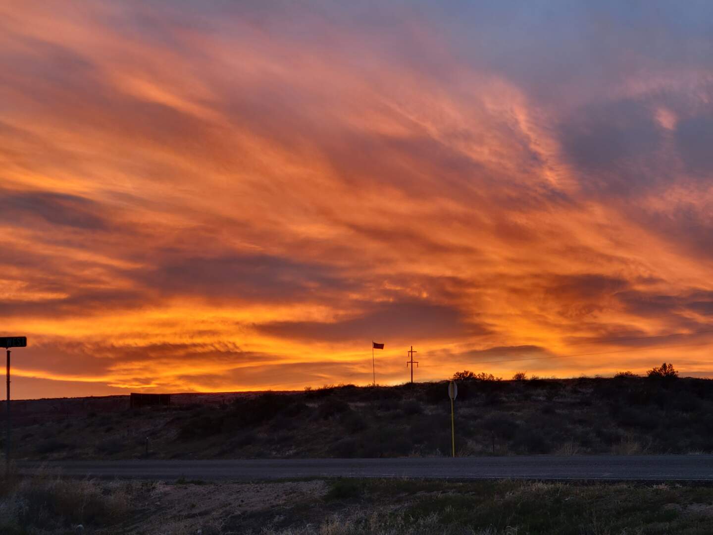
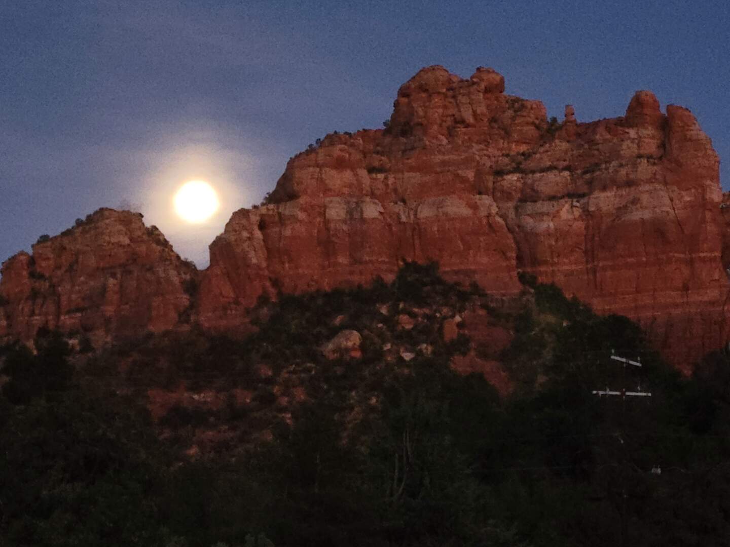
The wind was blowing particularly hard on this evening, you can tell by the flag. As the sun set, the clouds moved like waves in the sky. What a memorable evening!
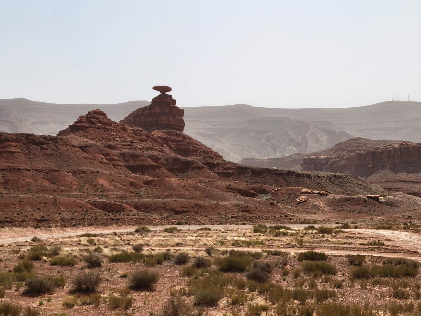
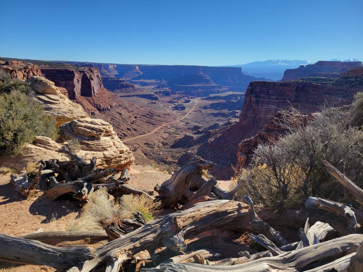
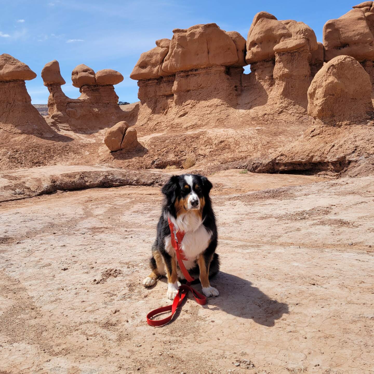
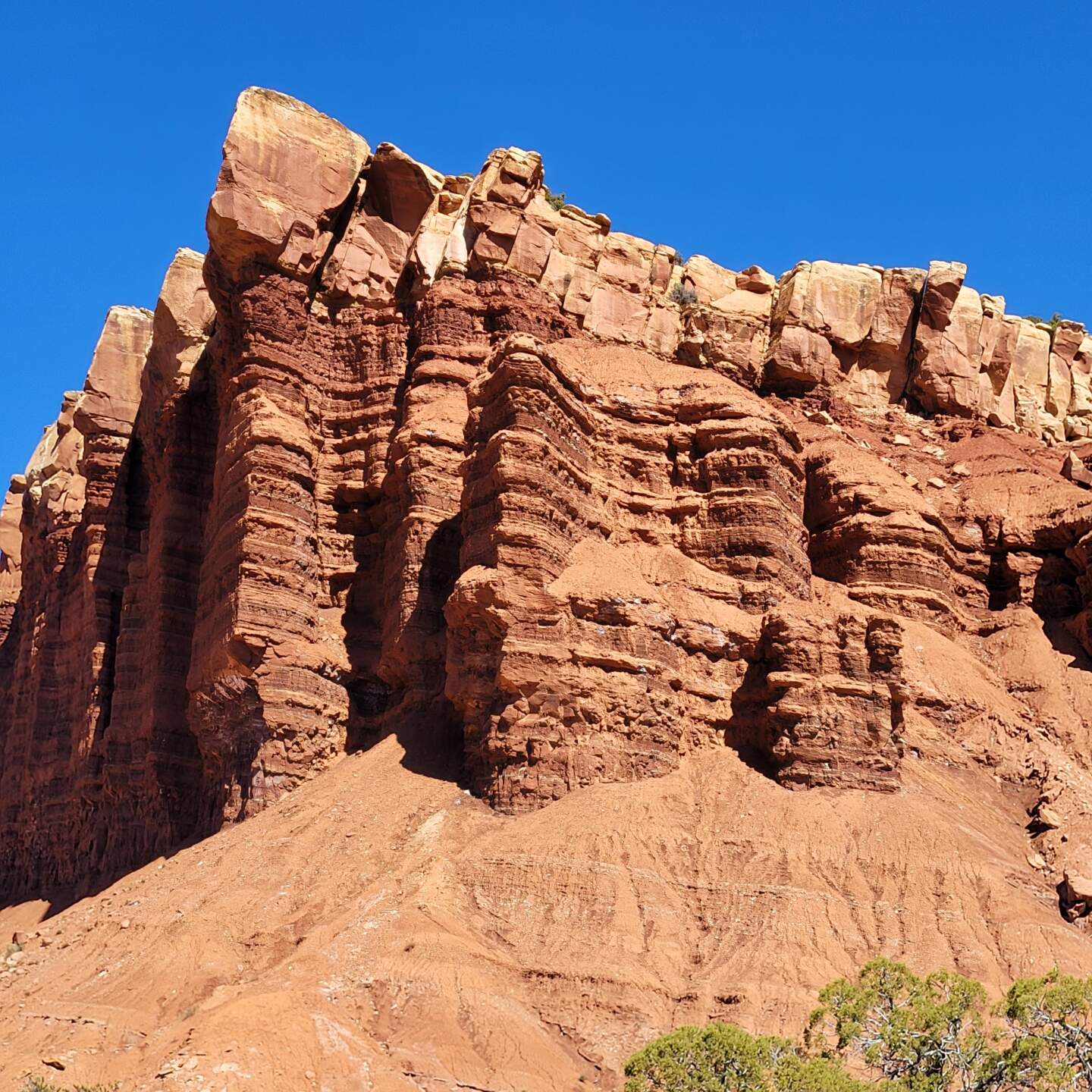
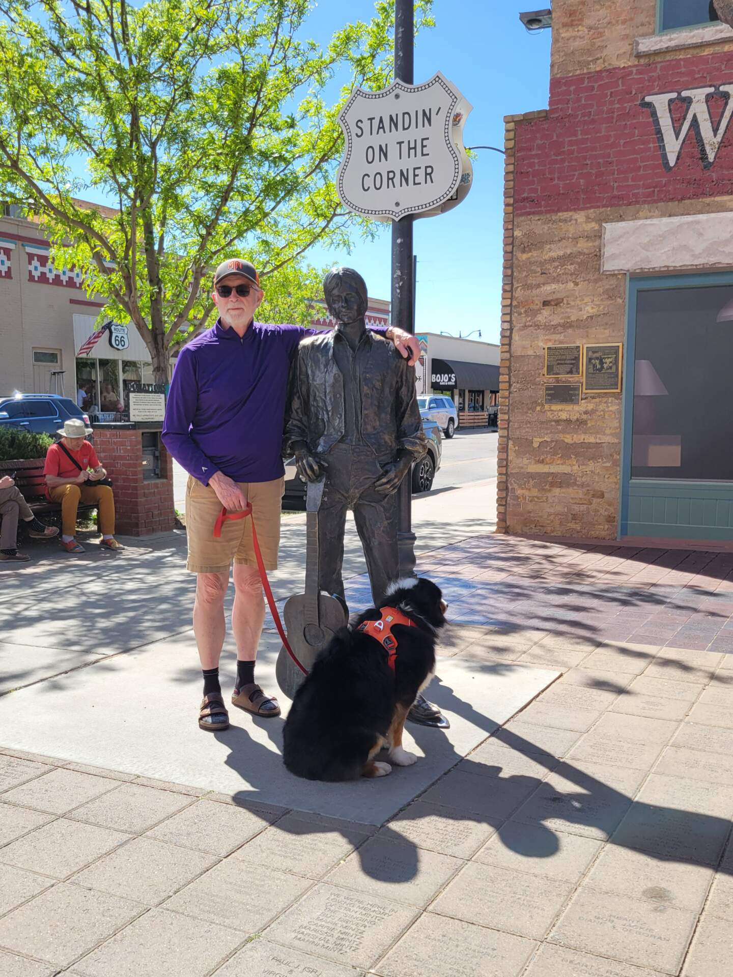
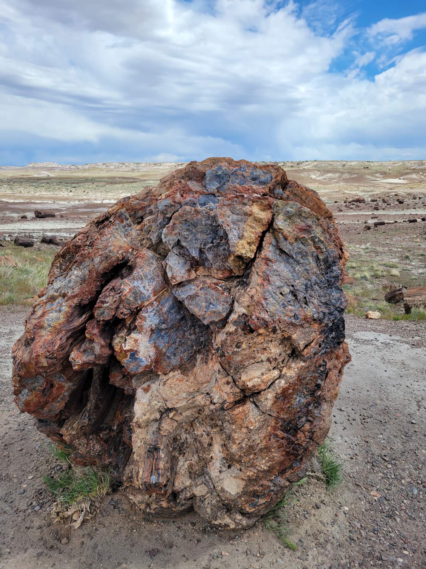
We covered so much territory on this five-week trip, saw so many sights that every time I sit down to put words on paper, my head spins. In sheer numbers, we spent 35 days on the road including 10 days driving to and from, covered 5,000 driving miles, visited 7 national parks (Mesa Verde in CO, Arches, Canyonlands, Capital Reef, Bryce Canyon, Grand Canyon and Petrified Forest), 2 national monuments (Bears Ears and Escalante), 1 national recreation area (Glen Canyon), 6 state parks (Gooseneck, Goblin Valley, Escalante Petrified Forest, Pink Coral Sands, Kodachrome Basin and Homolovi) and 2 monuments on Navajo Tribal Land (Monument Valley and Lower Antelope Canyon). We also enjoyed a really great meal at a James Beard Foundation 2023 Semi Finalist restaurant, Hell’s Backbone Grill and Farm in Boulder, UT, spent half an hour “Standin’ on the Corner in Winslow, AZ”, plus hours in Sedona galleries, roadside Navajo jewelry markets and numerous other stops at notable rock formations, historic sites and small towns. It was a whirlwind tour!
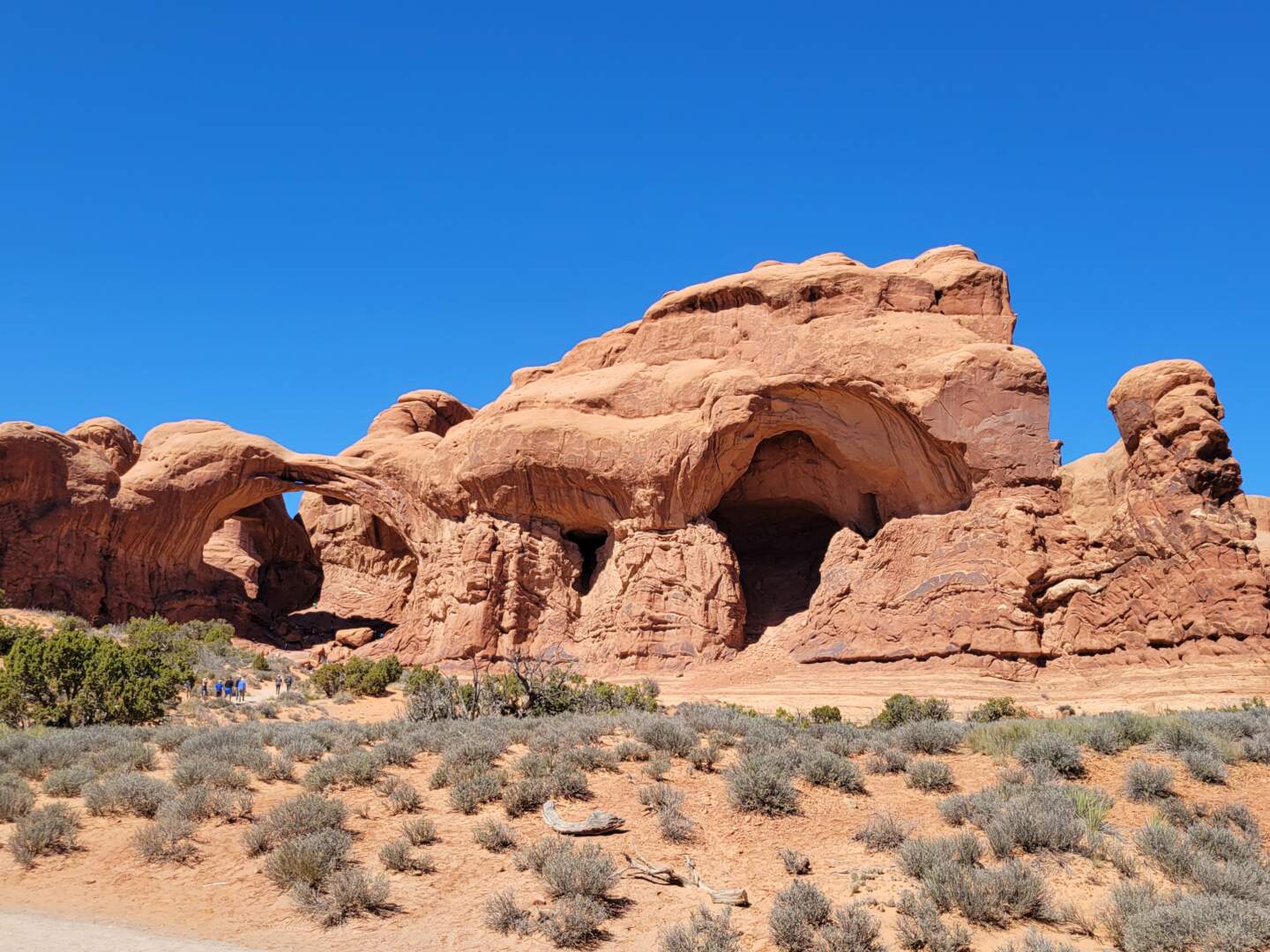
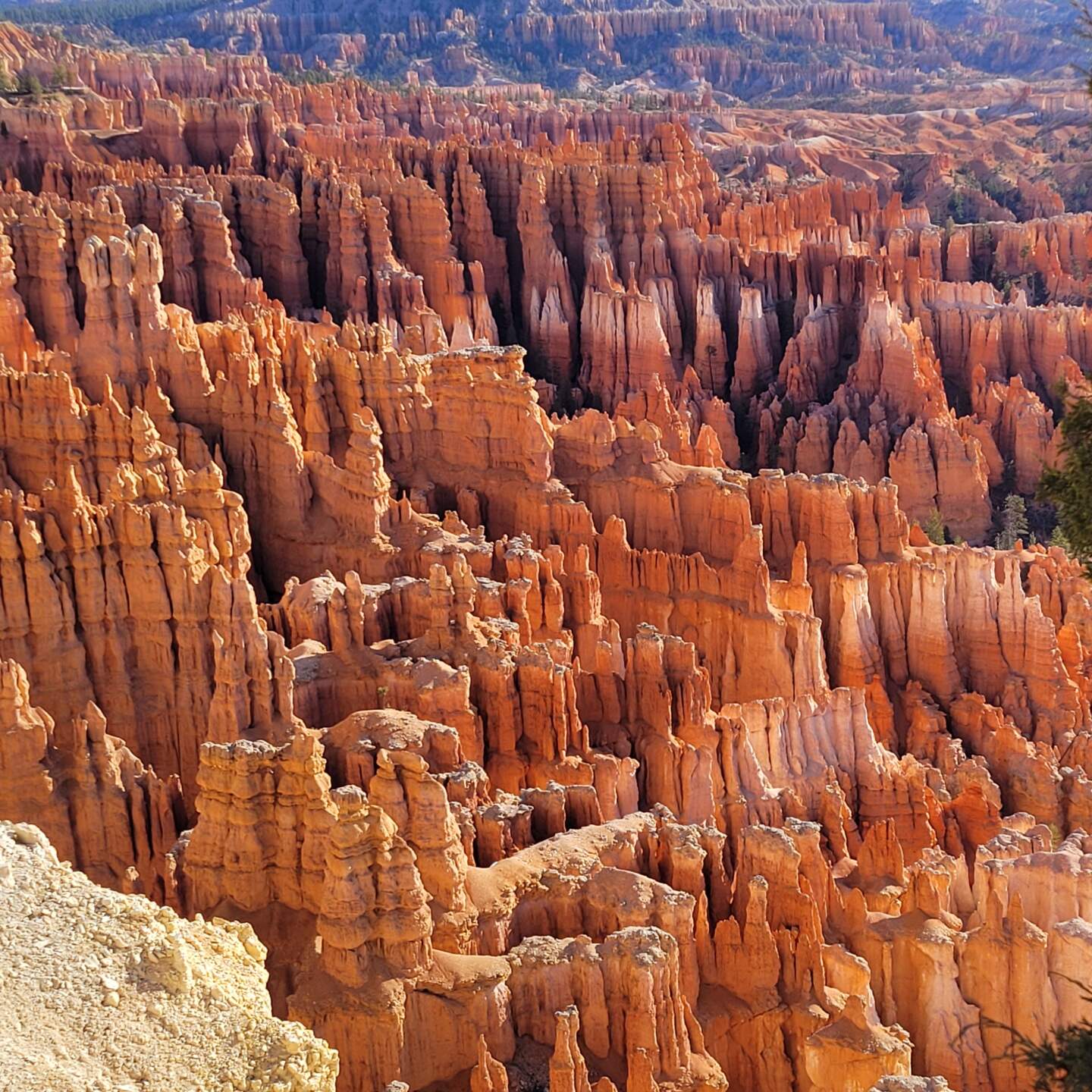
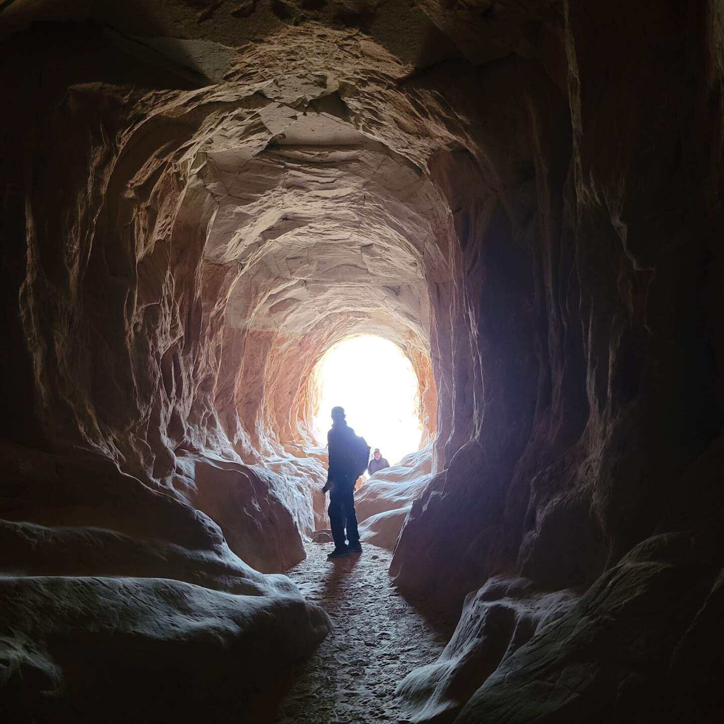
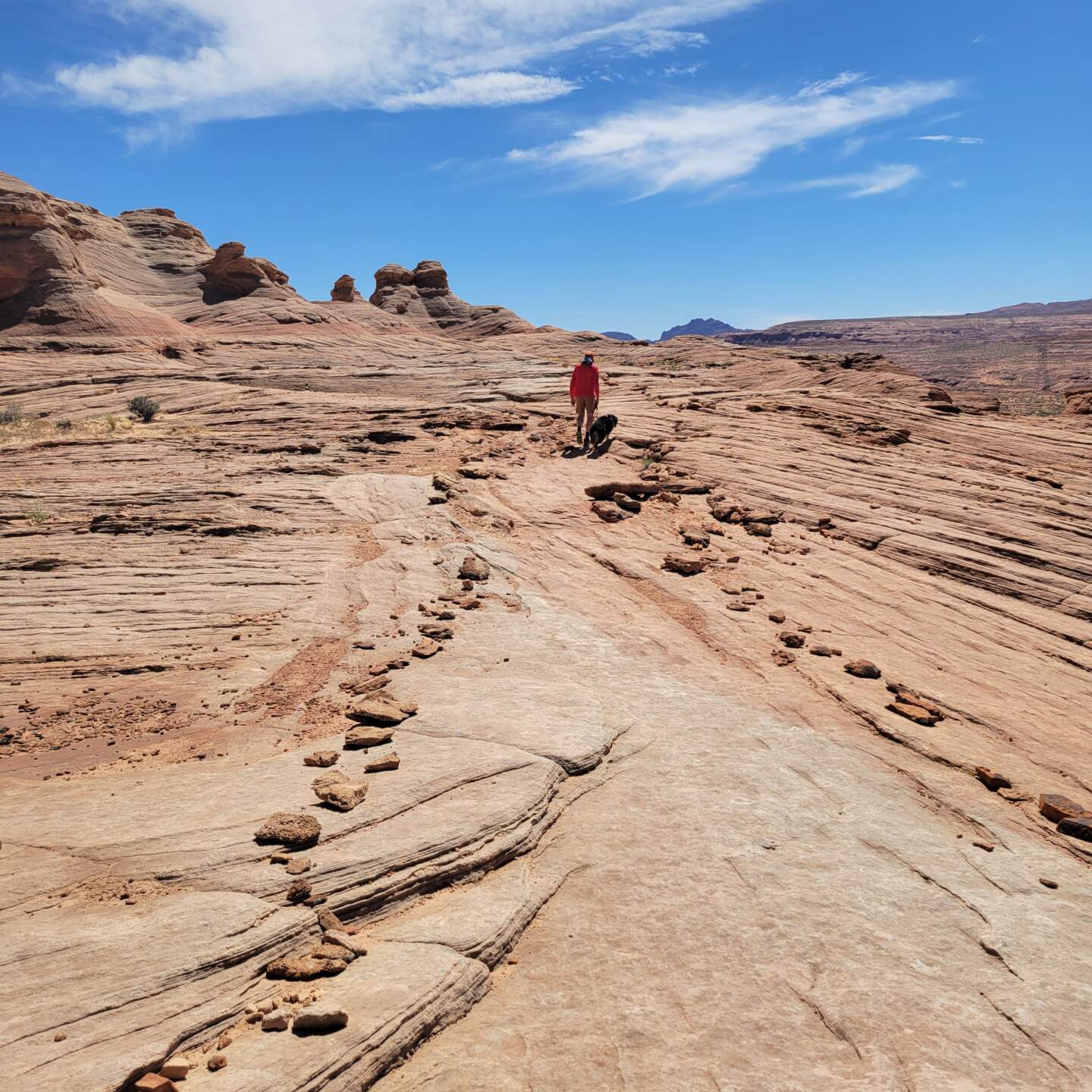
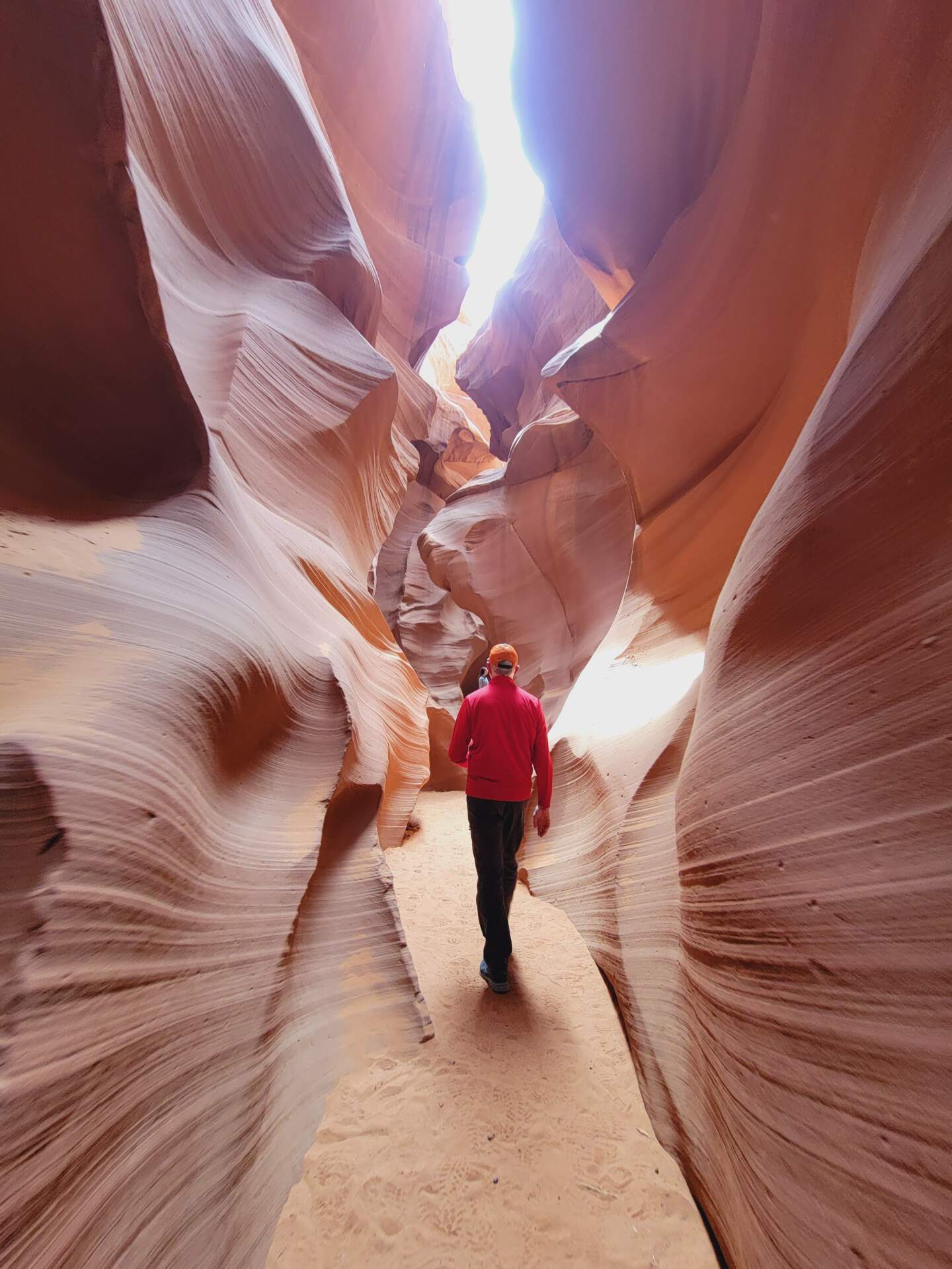
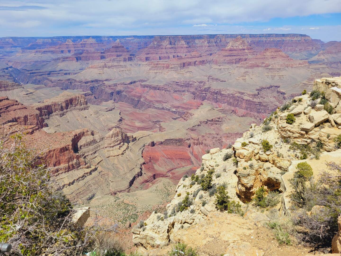
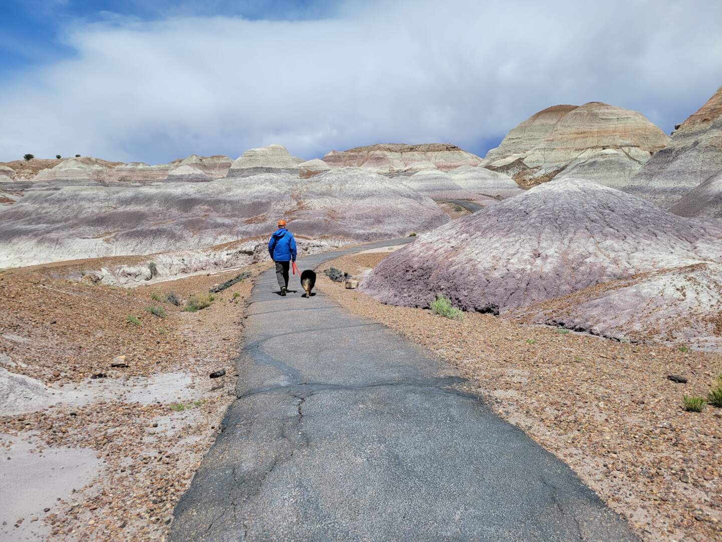
As we traveled, I spent my days following our route via an atlas, gps, posting an occasional update on facebook and often pointing out rock formations which seemed like carefully crafted sculptures. I know John could see the everything I could see but I couldn’t help my “oh looks” and “can you believe how beautiful” and a few “wows.” If I had to pick a couple of favourite places (I have many), I would say 1) Lower Antelope Canyon (Page, AZ) whose beauty lies in dramatic folds of earth, lit from above by light seeping in from cracks in the earth, 2) Bryce Canyon National Park (Bryce Canyon, UT) with its colourful and otherworldly spires and 3) The Grand Canyon (near Cameron, AZ) for the sheer vastness of width and depth, hard to photograph, hard to comprehend. My friends, who travel to the southwest every year, disagree with me, their list of favourites is very different.
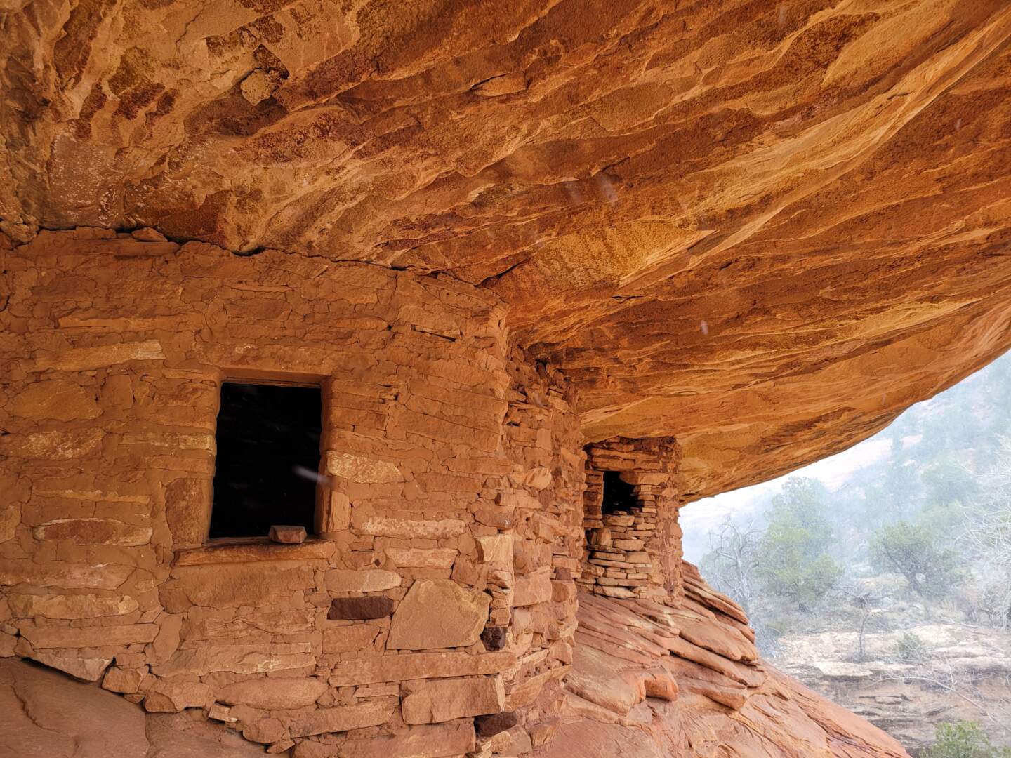
While this area is heavily Native American Tribal Lands, the Navajo and Apache having arrived here before the 1500’s, I often tried to imagine what drew others, “settlers,” to this land that is heavy on dirt, rock, dust and wind, sparce of population and mostly lacking in available fresh water. Could it be the wind sculpted rocks, the gorgeous sunsets, the vast starlit night skies, the miles and miles of empty landscape or the small, lightly populated towns located along our route? My guess is one moves here for a sense of independence, a desire for some level of isolation and the willingness to scratch out an existence in mostly barren land, nonproductive land. As starkly beautiful as it is, the southern Utah and northern Arizona environment felt hostile at times, both in living conditions that one must endure and the weather which we found intensely hot in the sun (and we were visiting in the “cooler” month of April), cold in the shade, dry and dusty, and the wind, the wind blew relentlessly.
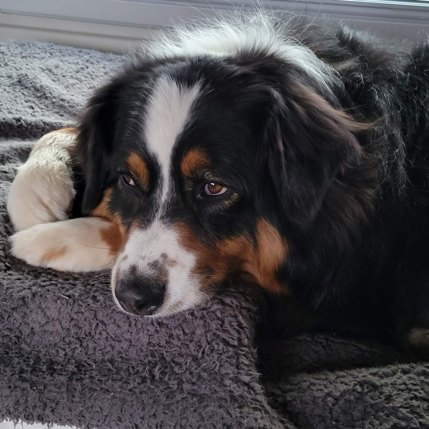
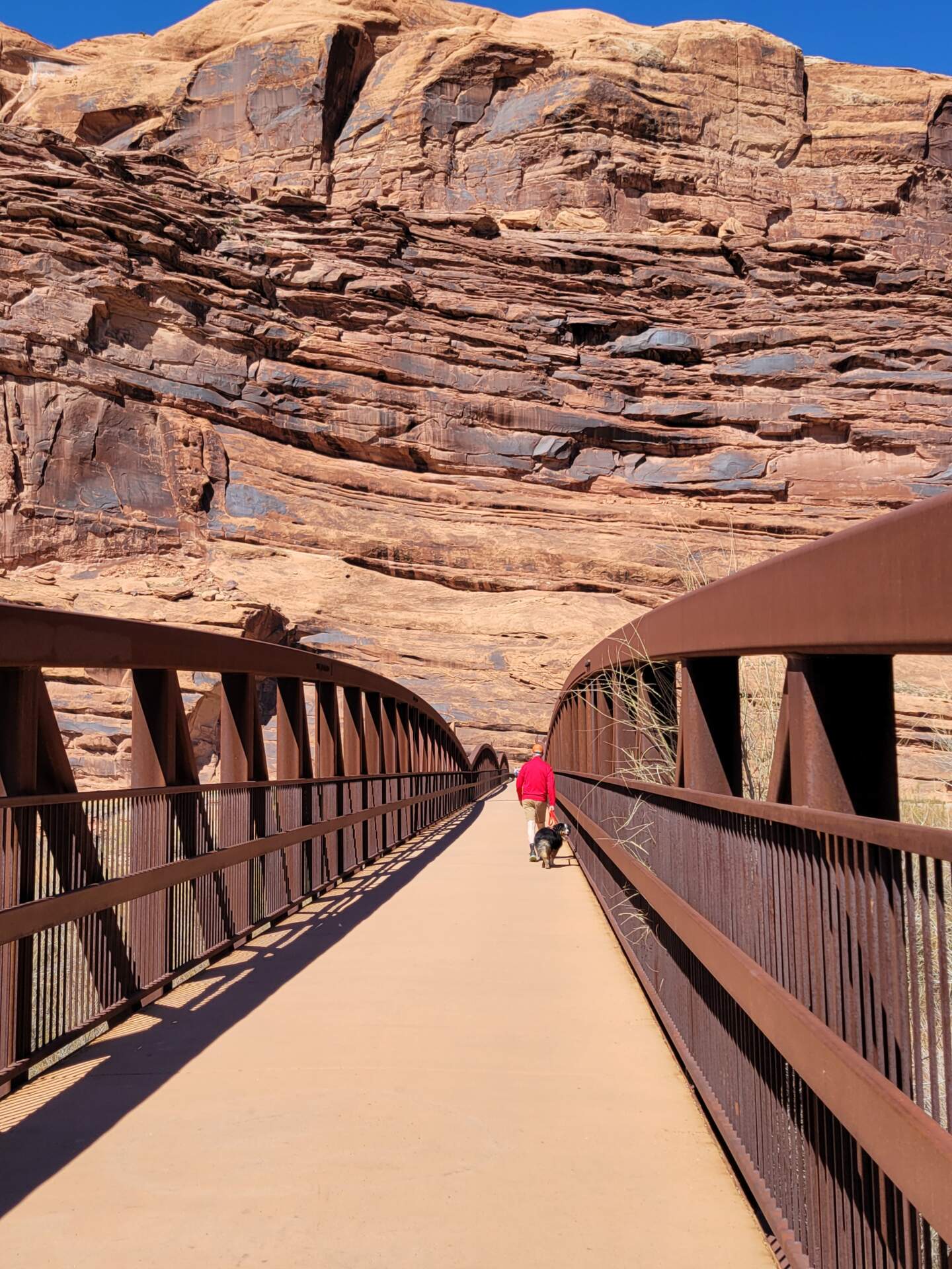
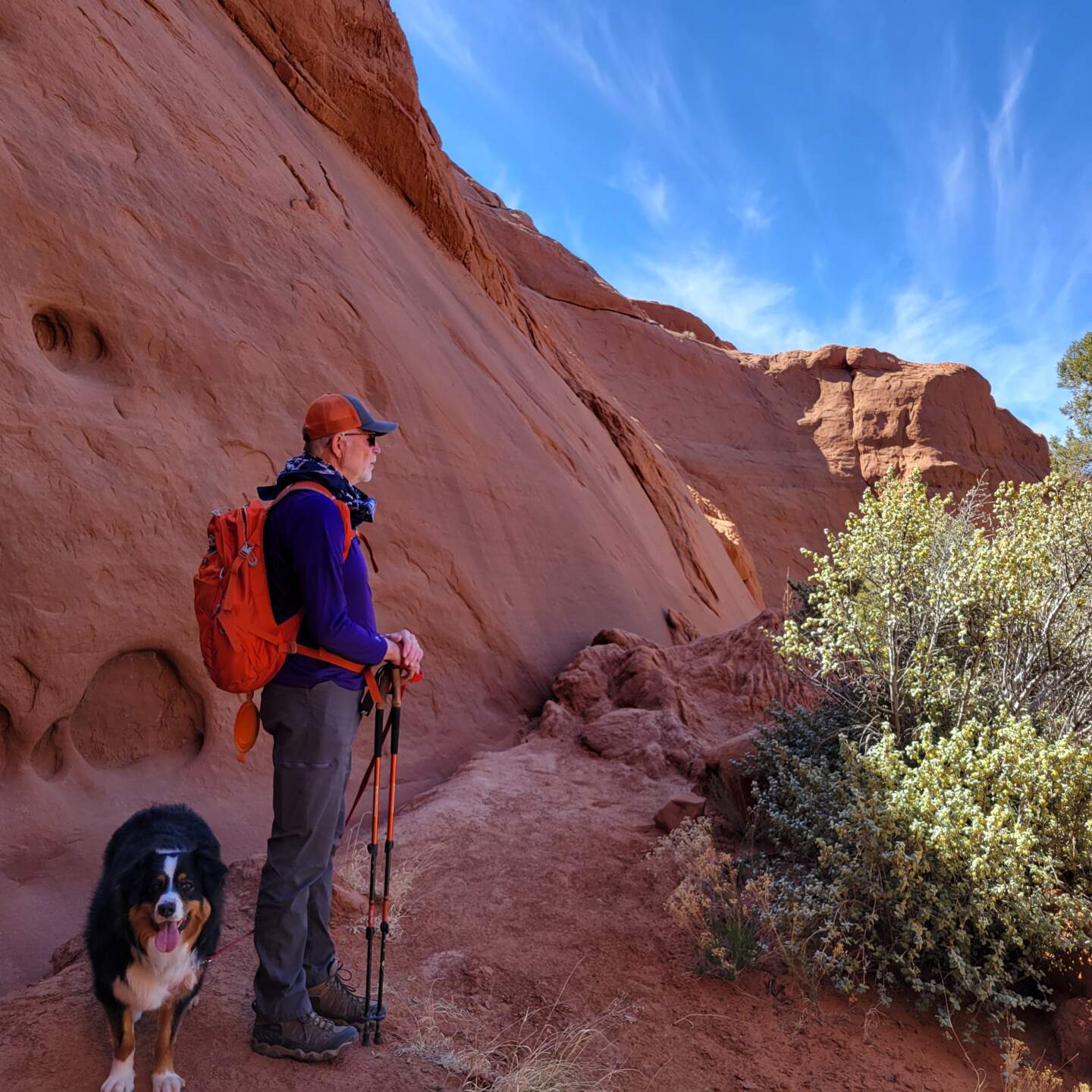
“The Silver Beast,” as my sister has named our van, provided our transportation, protection from the elements and a place to lay our heads at night. While only 21′ in length and under 7′ wide, the Silver Beast is equipped with a kitchen, bed and a small bathroom. The compact size guarantees that we can park in almost any space designed for a car. The thing about the small space is that it can feel confining at times, especially with a 60-pound dog as a ride-along. Because only one of us can be up and moving at a time, it is not unusual for me to struggle with irritability the first few days of a trip. It takes a few day to adjust to my space restrictions. The plan, of course, is to be out and exploring, not sitting in the van but this is not always possible.
On this trip, my irritability flared on several occasions, along with muscles and tendons in my hip that I had aggravated in early March. Walking was hard on some days, but it was random. On the more painful days, I was wistful for my home space in Knoxville and cranky about everything. On the no pain days, I was ready to go. Luckily for me, most hikes occurred on no pain days! I am, however, very glad I married a patient man.
We went days at a time without what would be considered a proper, or even improper grocery store. Some general merchandise stores in larger towns such as Escalante, population 900 and a tourist destination, had a limited selection of fresh food. Gas stations sold some fresh, but lines of locals could be long when trucks arrived to restock. On one particular leg of the trip (Bluff, UT to Torrey, UT), we decided to backtrack through Moab to take advantage of a well-stocked grocery. Though Moab was, at this point, a several hours reroute, the diversion worked out well because we passed by Goblin Valley State Park which was “on my list,” and sight that would have been several hours diversion on another day.
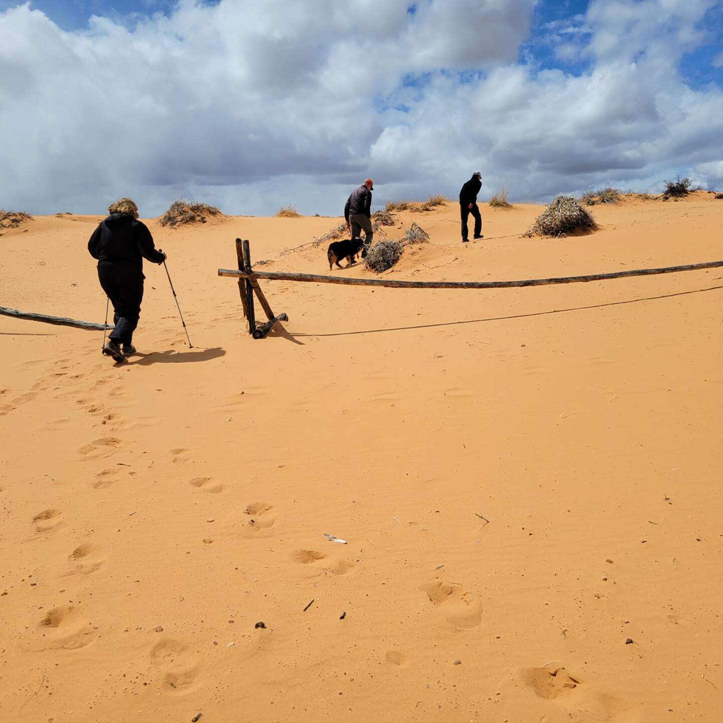
Every night (except those on the drive home), was planned and booked far in advance of our departure. After 15 trips in the van, I had hoped we would be able to travel with more flexibility in our schedule, but we have not reached that point yet. As a result, we booked too many nights in a couple of places, Coral Pink Sands State Park stands out in my mind. Several sights in this area did not pan out as I had hoped nor did my plan to sandboard down the dunes, so staying one more day did not make sense. Bob and BJ, our friends from Washington State left to go home a day early and we ended up spending an afternoon shifting all our campsites forward by a day.
So that’s a wrap on this post that has taken several days to get on paper. While I will not become a springtime regular to the southwest as some of my friends are, if I have another opportunity to travel there again, I will. There is still so much to see and do!
Oh, shoot, my comment did not appear. Maybe you have to approve them. Anyway, I like the looks of your two faves. I’ve been to Bryce and many of your other stops, but Antelope Canyon is on my wish list for the future! Awesome trip.
Author
I do have to approve, so much spam when I leave the comment section open. Would love to know which stops you have and haven’t visited. The area is absolutely beautiful! Are you traveling this summer?
Fantastic trip! I like your two favorites based on the photos. I’ve been to many of your stops but not others; of those, Antelope Canyon would be my top choice to go and see!
Really enjoyed your take on so many places I’ve visited, but over many years. My top 3 of the places you visited would be Bears Ears, Bryce Canyon, and Escalante. Overall, considering places you didn’t visit, I’d list the Wave, Coyote Gulch in the Escalante area, and Slickhorn Canyon on Cedar Mesa in Bears Ears.