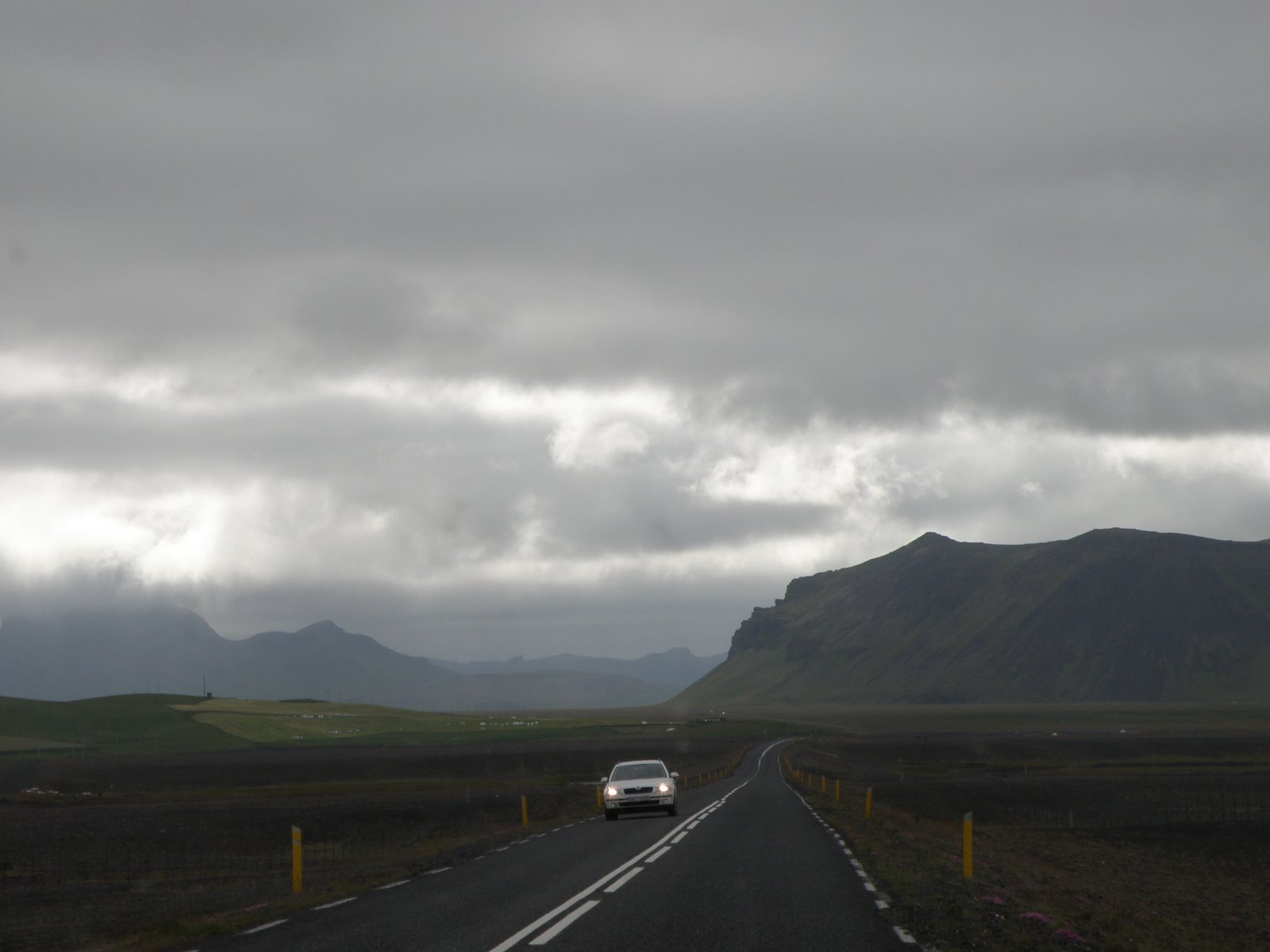
Day 2 and we were on the road by 9:00 AM. Breakfast is served late around these parts (8:00-10:00) or are the locals just more relaxed than a group of uptight Americans on holiday? The sky was overcast and the temperature hovering in the low 60’s but the relentless wind kept the “feels like” temp in the 50’s. We were told we missed the sun and heat last week. Most Icelanders are glad to see clouds and the chance of rain as their lush green fields were beginning to turn brown.
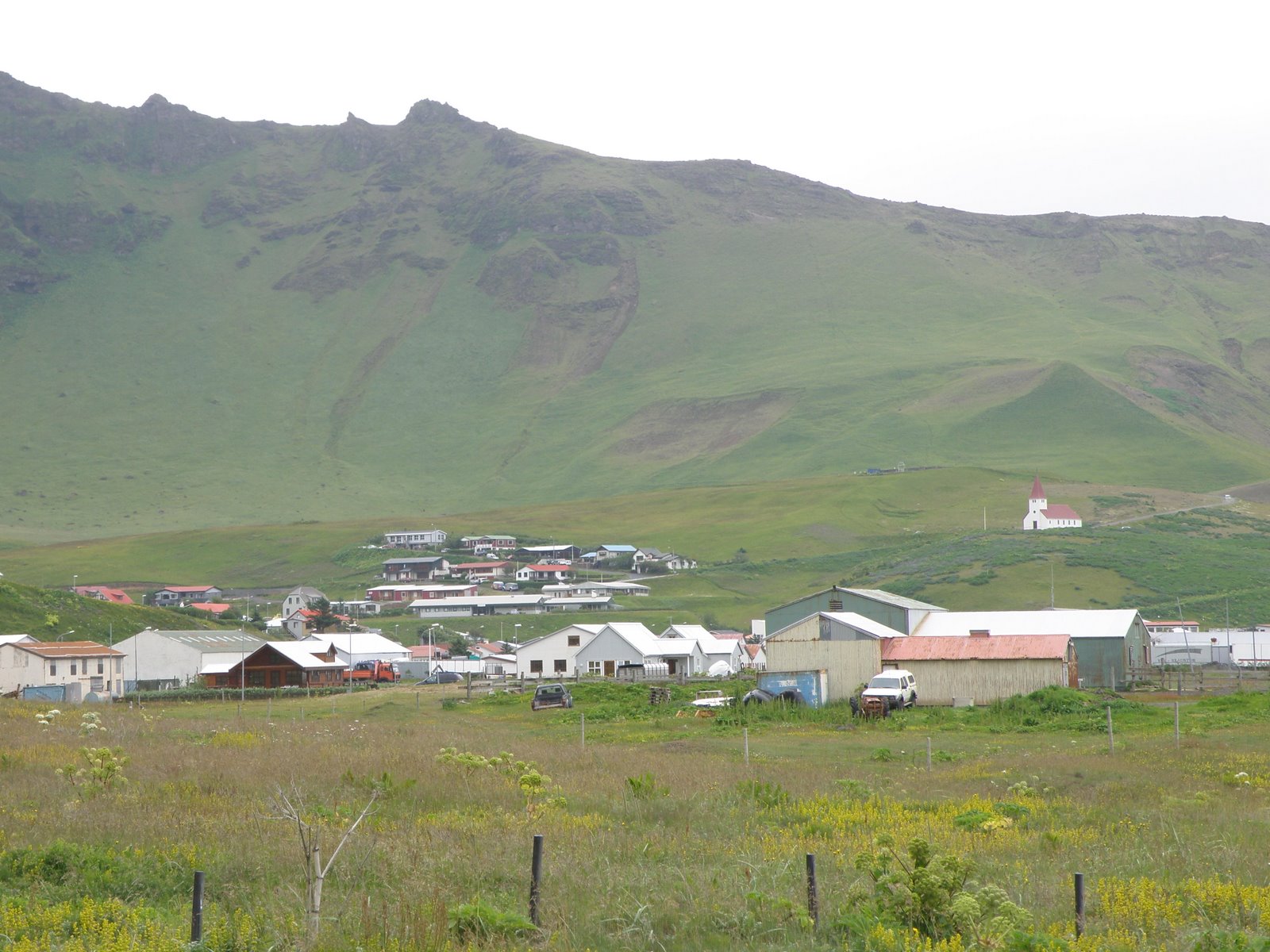
 Our first stop was in Vik, a town of approximately 300 inhabitants and an official trading post since 1887. We note limited eating establishments and are happy we stayed at the farmhouse for dinner.
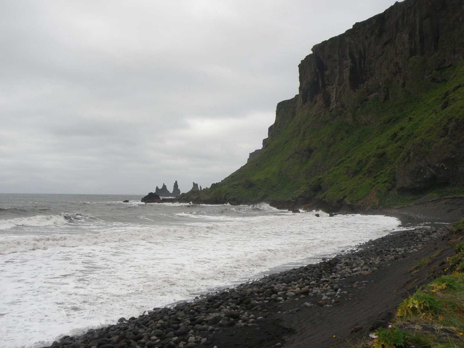
 Vik is on the coast, “about 40 minutes from last night’s lodging and on the other side of the Dyrholaey cliffs. This is the view “from the other side,” along the coast of Vik.
 Back on the highway, lava fields stretched for miles, the ancient Eldraun Lava to be exact, from an eruption in 1783-84.
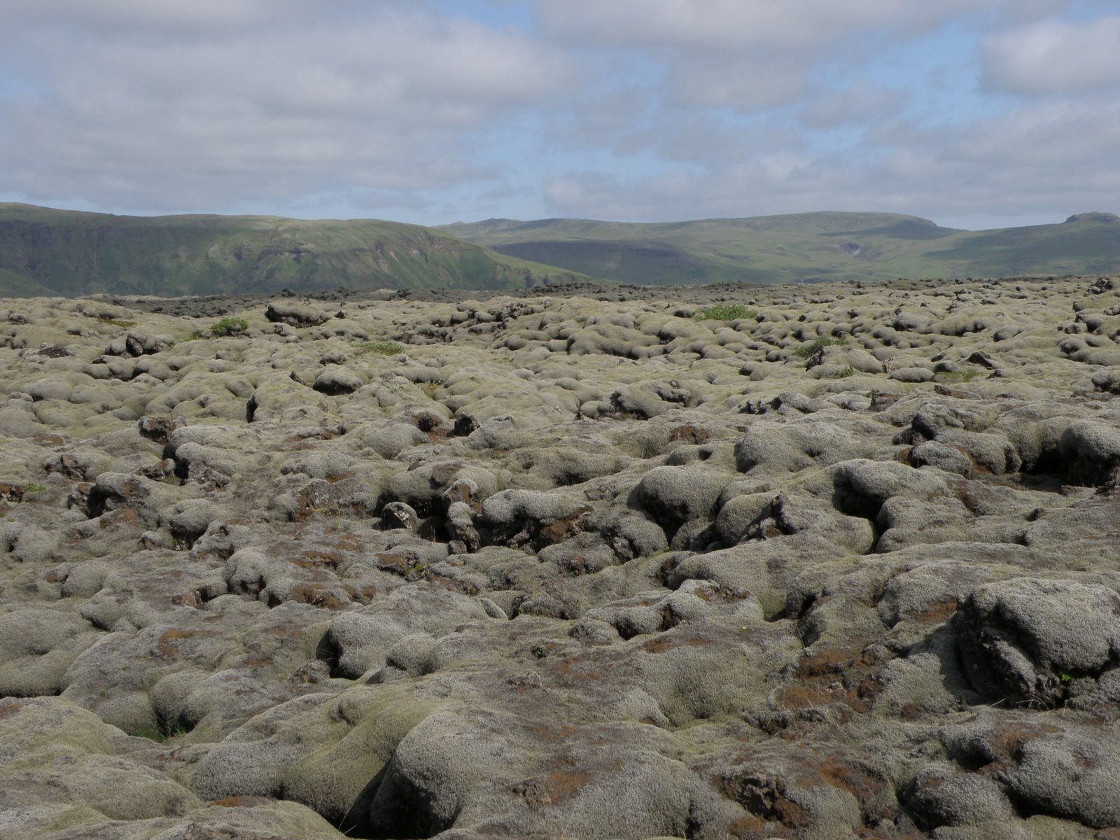 An interesting, gray moss covered the lava. The whole scene looked like one might imagine the surface of the moon.
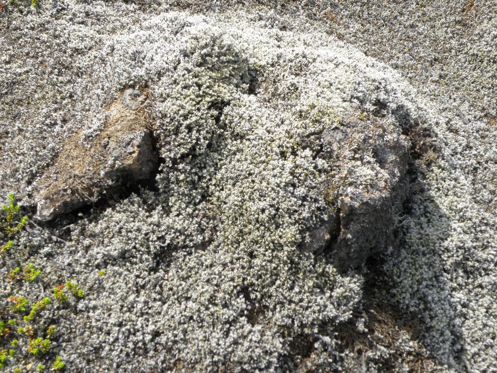
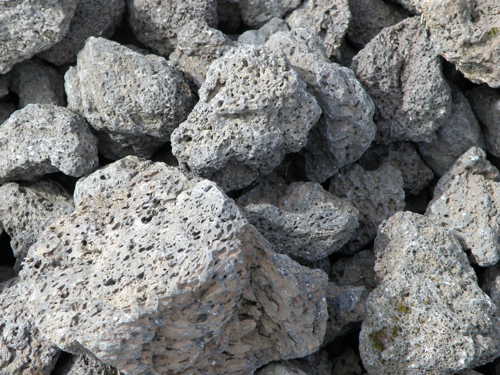
Lava rocks along a dry glacial river bed.
 Systrastapi (The sisters crag) was up next. Are you keeping up with me on the names?! A convent was located in this area from 1186 until the Reformation in the 16th century.
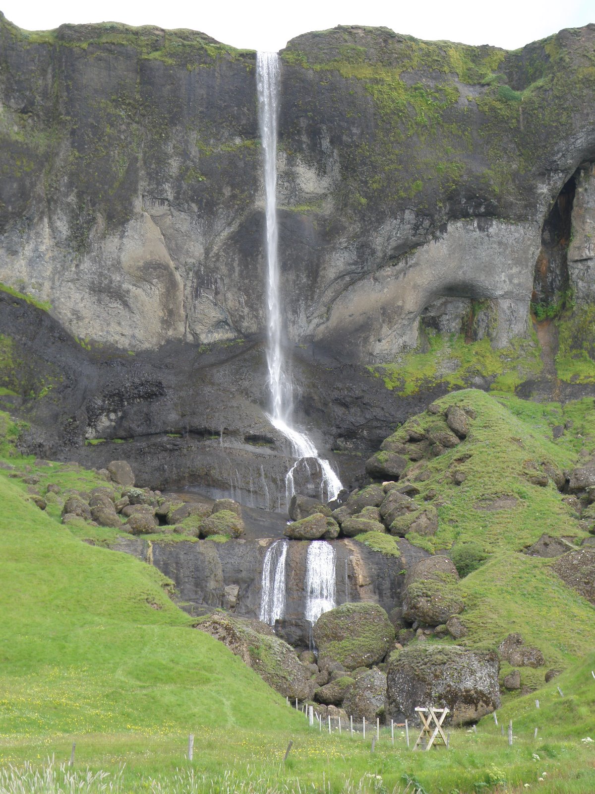
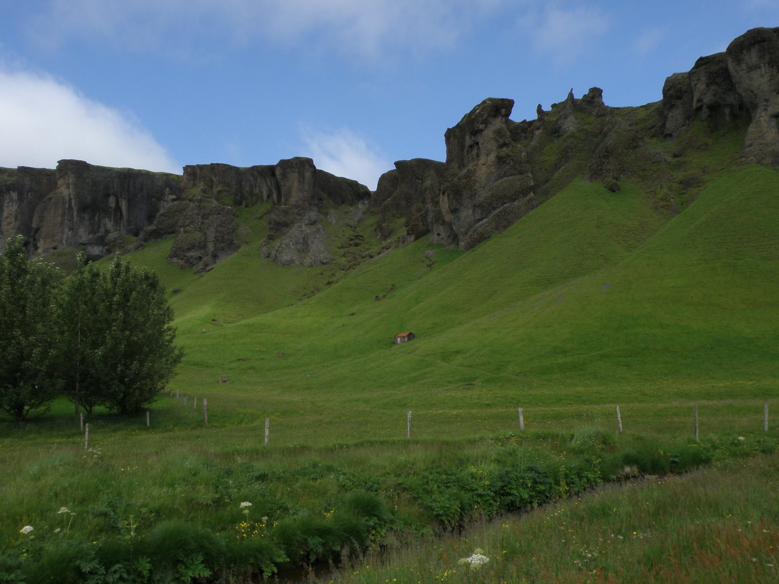 Systrafoss (The sisters falls) is located among the lush fields and rocky cliffs of Systrastapi. There are many shapes and sizes of waterfalls in Iceland but no uninteresting waterfalls!
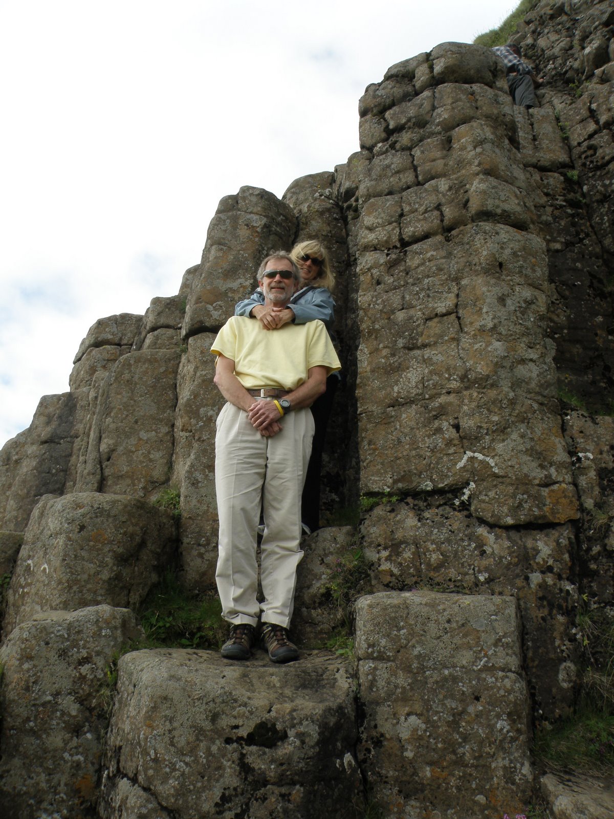
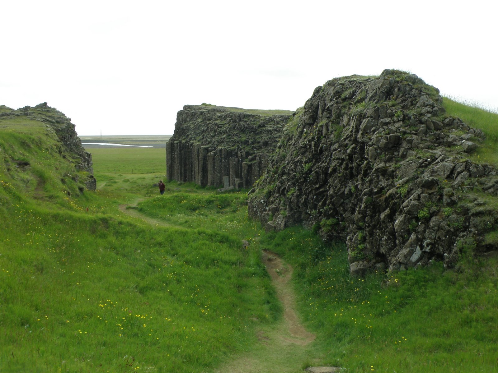
 We spent a bit of time hiking around Dverghamrar (Dwarf crags). The unusual, hexagonal columns are found when lava has flowed into water and abruptly cooled. We really haven’t climbed so high in the photo below although it looks like I am hanging on to John for dear life!
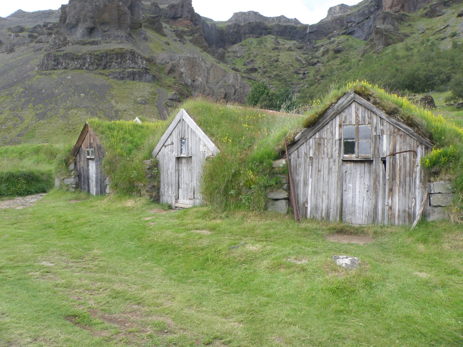
 Nupsstour was one of my favorite stops on the trip. The chapel is from 1850 and the farmhouse, 1900. According to the history of this farm, travel across the sands and rivers was extremely difficult before bridges were installed. Horseback was the only feasible mode of travel. The most skilled and experienced travellers in the area were respectfully known as “water men” and the horses known as “water horses”. This was the home of the last well known water man, Hannes Jonsson (1880-1968). He carried the post (mail) between Sioa and Hornafjorour. The buildings in the below picture were used for storage. Three peaked roofs is a common theme in old and new Icelandic architecture.
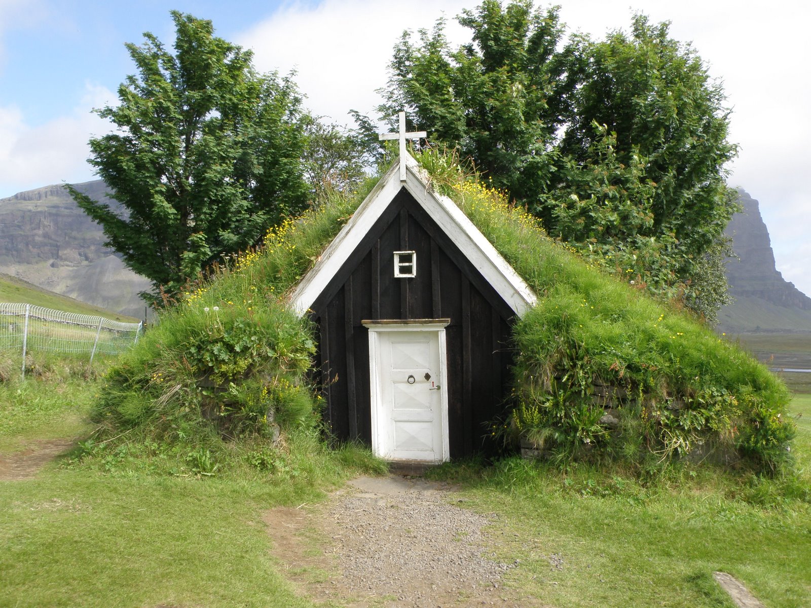
 This is the chapel on the property. Many farms in Iceland, new and old, have small, private chapels. Hannes Jonsson is buried behind the chapel with several family members. Behind the chapel, you can get a glimpse of the mountain Lomagnupur, which once rose from the sea and now rises from the sands. The a large section of the cliff collapsed in 1789.
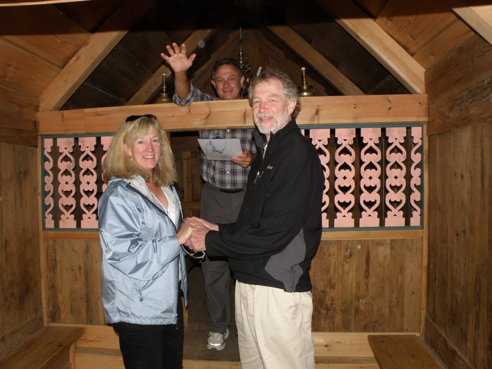
 Off and on before the trip, we discussed getting married in Iceland. In retrospect, we wish we had. We decided this chapel would have made a memorable wedding site so we held a “mock” wedding. Below is our “wedding” photo from the chapel with Will acting as the minister. Not sure I will wear my hiking rain jacket for the real occasion.
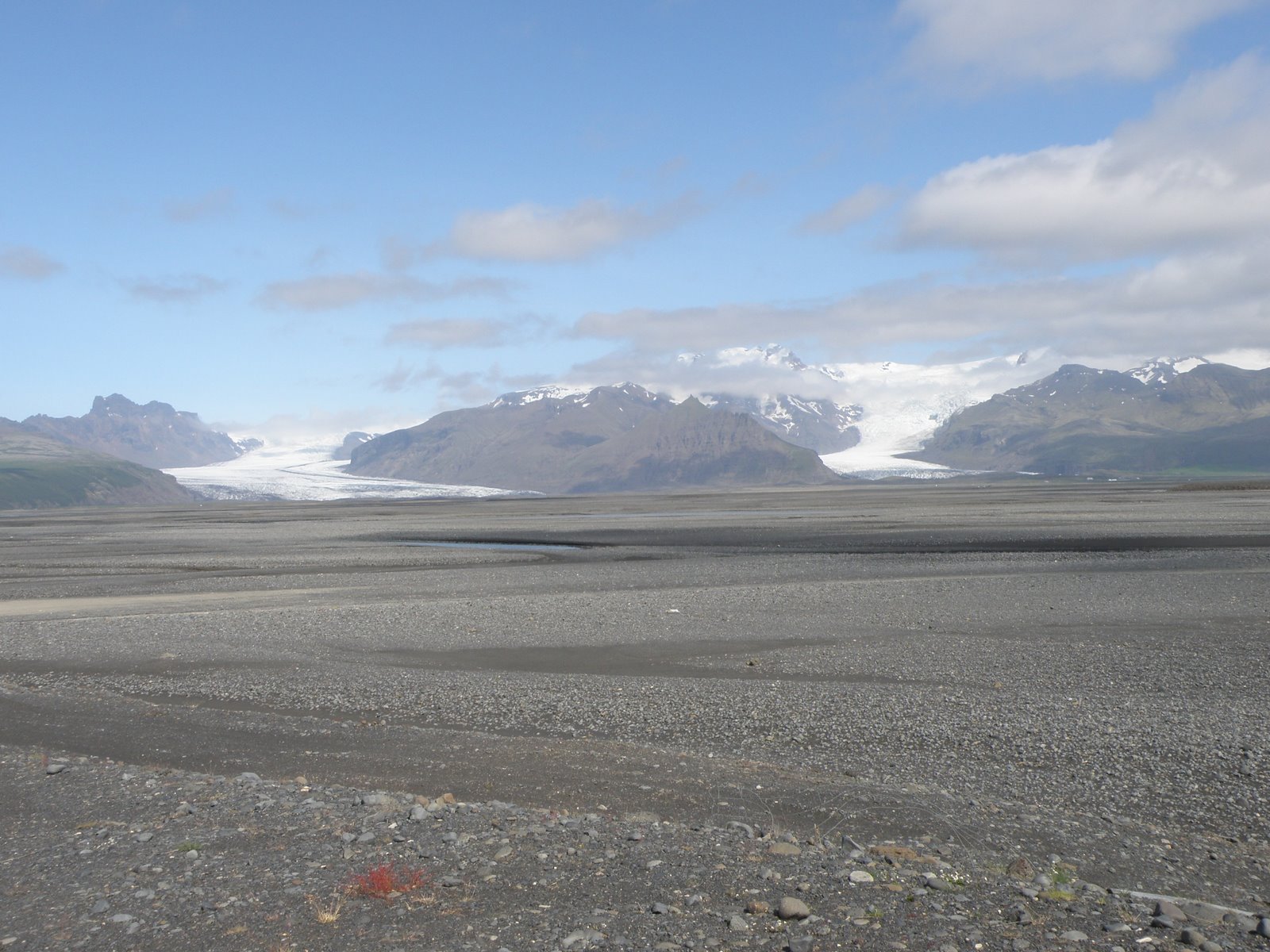
 A view of the magnicient Skeioararjokull glacier comes into view behind Nupsvotn, a wide and multi-streamed glacial river. It is obvious that this river rises considerably during glacier and snow melt. In the photo below, a narrow blue line indicates where the river is flowing on this day in mid-July.
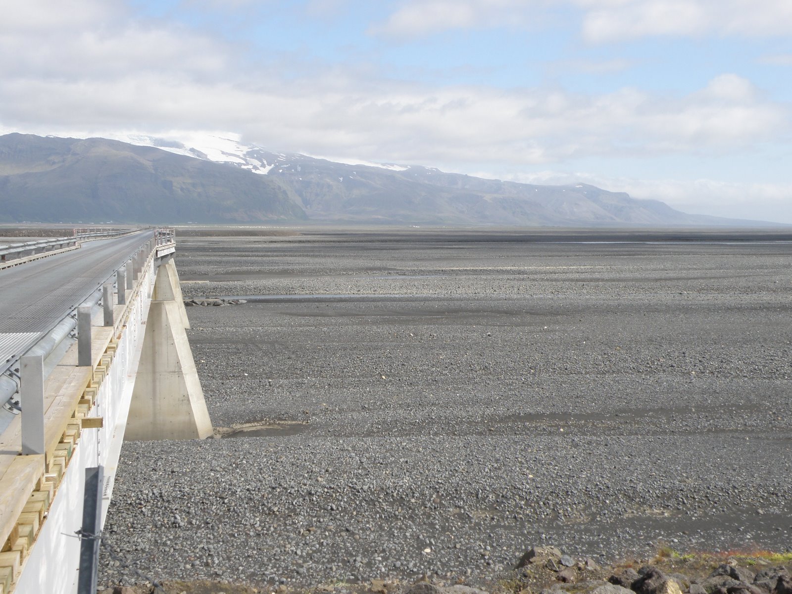
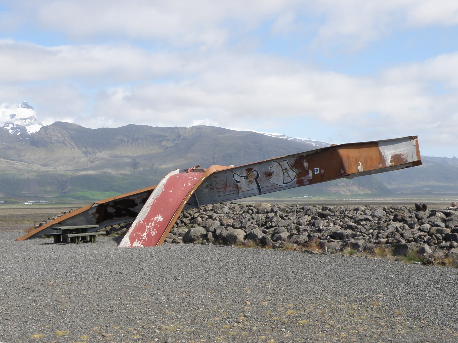
 The photo below is of a bridge built in 1996 over converging glacial rivers. In 1974, a bridge was built in this area, one of several bridges that finally completed the ring road. Considerable volcanic activity in the Vatnajokull glacier destroyed this bridge and damaged several others in the area. The second photo shows metal from the original bridge, it was washed downstream. The metal was left as a sculpture and a picnic table added to make it a “roadside” site.
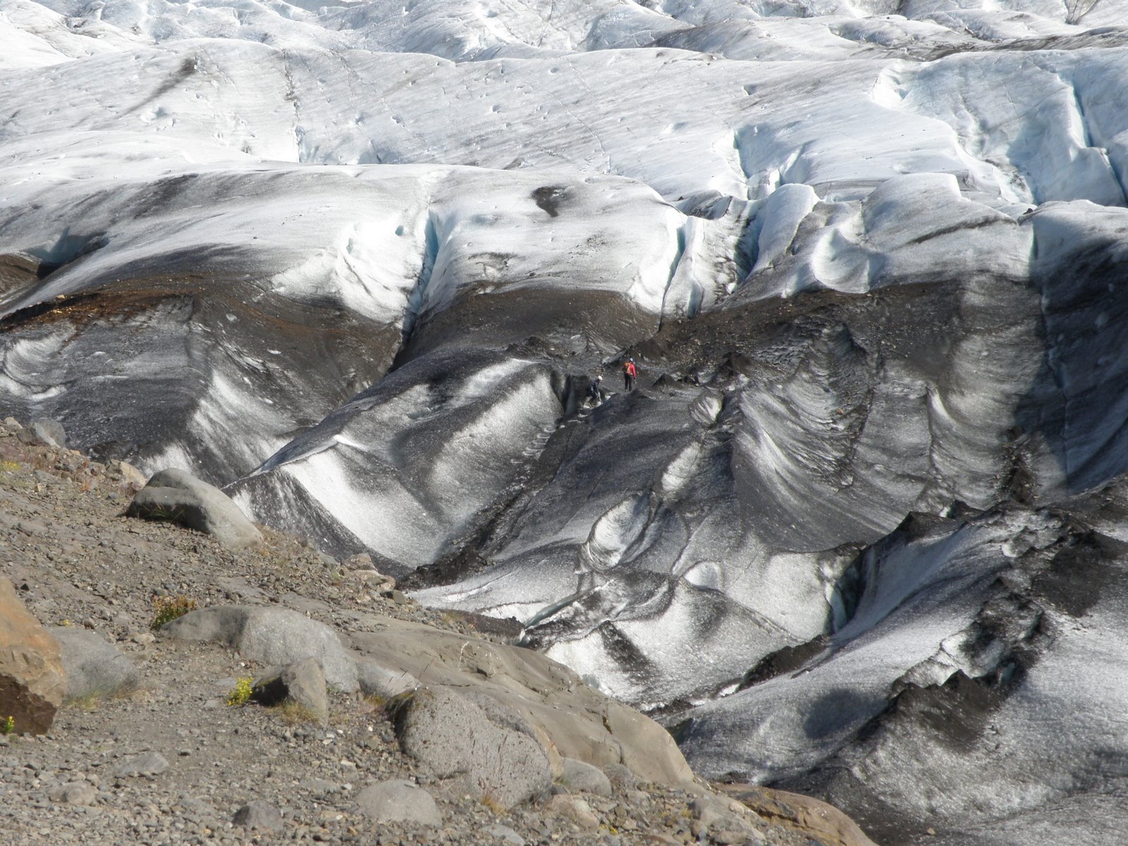
 We stopped and hiked to the glacier in Skaftafell National Park. Unfortunately, we did not have time to hike on the many trails and enjoy the lush scenery in the park. This was the first up close glacier experienced we had in Iceland. If we had more time, we could have hired a guide for a 2.5 hour hike on the ice. You can see a small figure in red walking below.
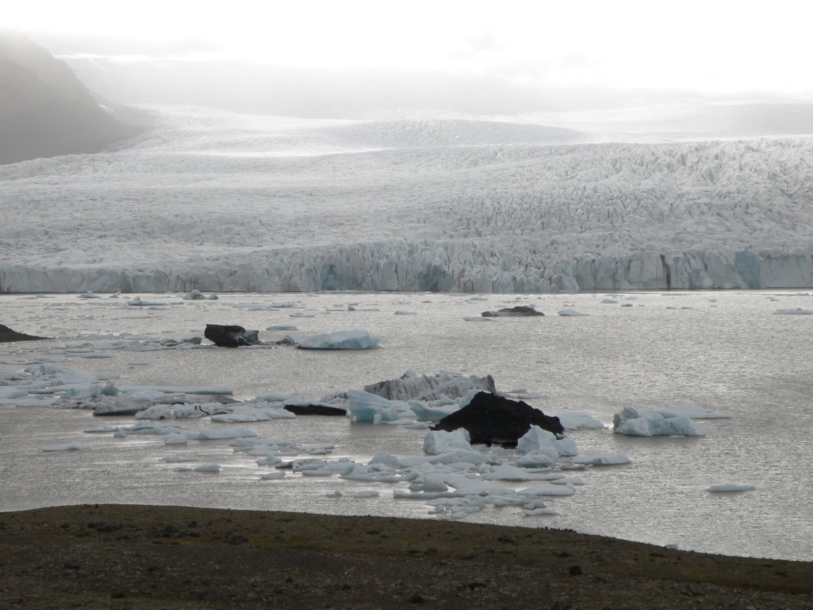
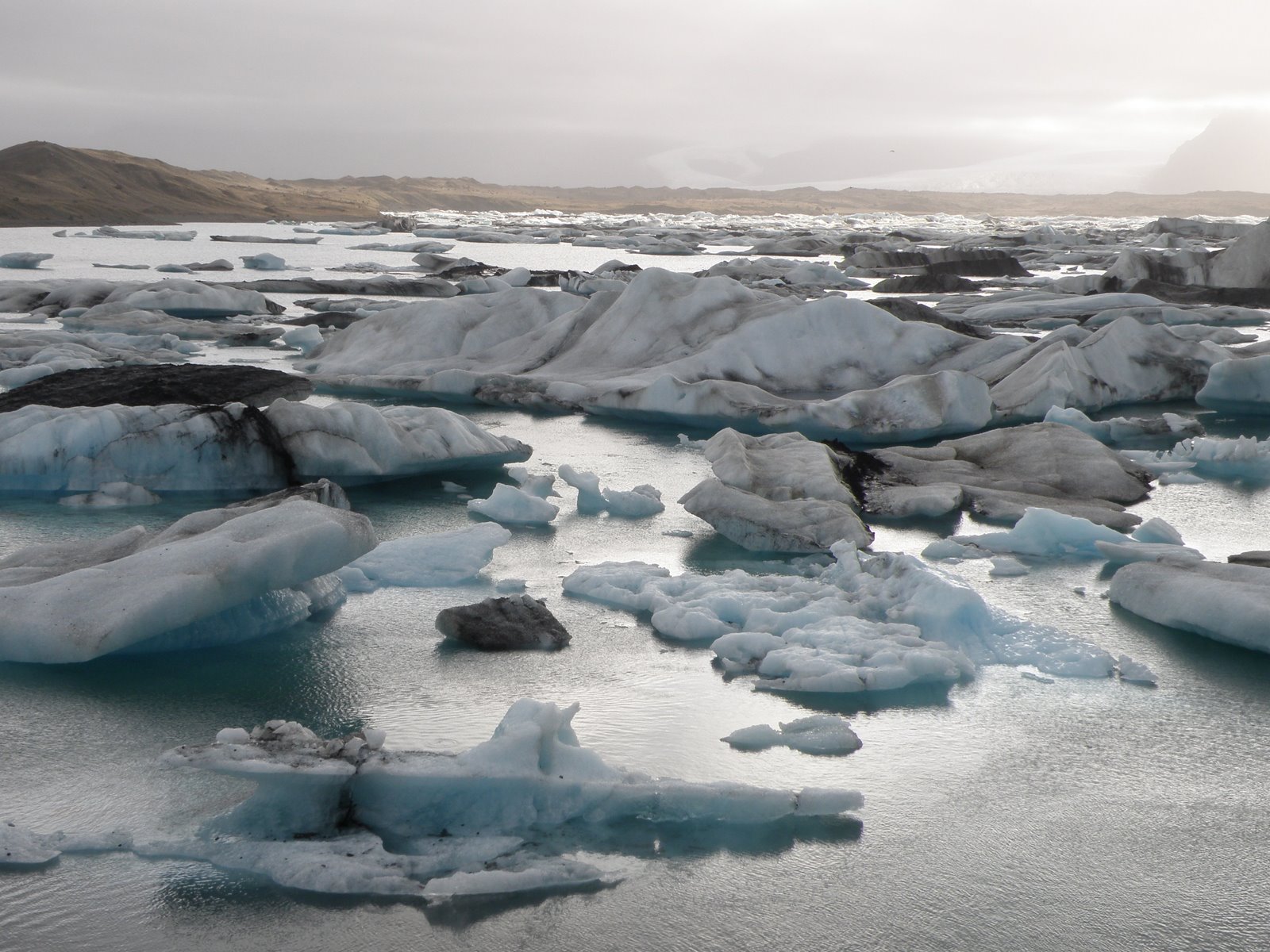
 Our last major stop for the day was Jokulsarlon Lake. The lake is located at the foot of a glacier and is best know for it’s floating icebergs. The icebergs bump around the lake until they are reduced in size. The burgs then make their way to the short, 1500 meter river, which flows into the sea. A bridge was built over the river in 1967 but the bridge is in danger due to encroachment from the sea.
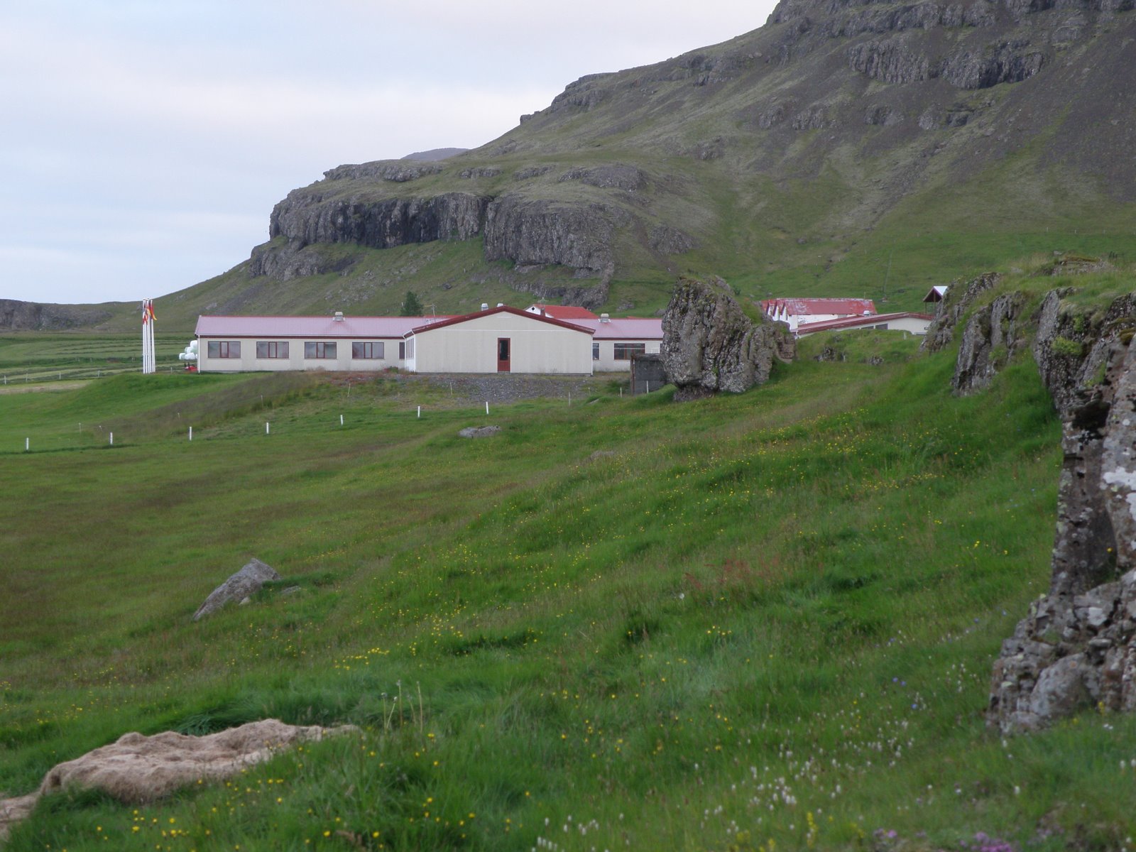
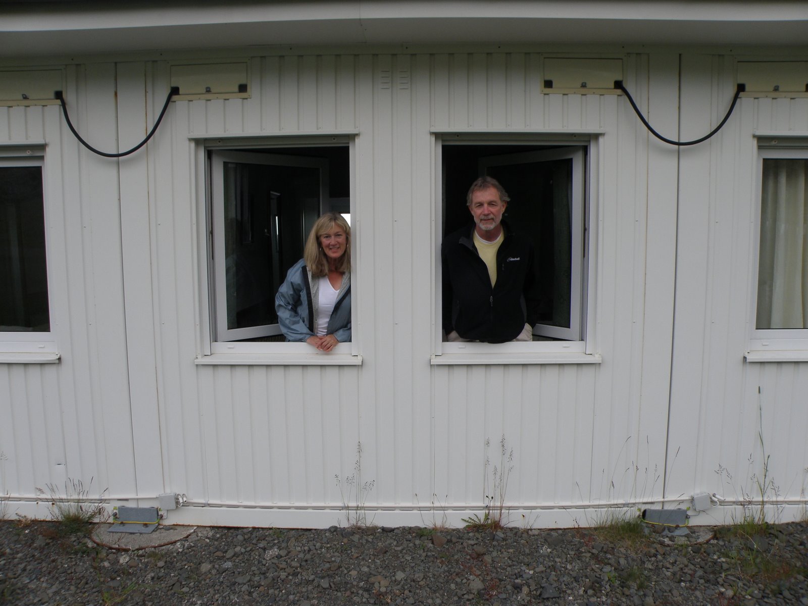
Finally we arrived at our night’s lodging, Smurlabjorg. This is the largest farmhouse we will stay in, holding 90 persons. It was filled mostly with a tour group. Though the accommodations are fine, there were too many people and we would suggest any small group bypass this farmhouse for other lodging. The first pic below is the lodge, the second is us looking out our bedroom windows.